The River
The Yadkin Pee-Dee River Basin
The Yadkin Pee Dee River Basin is North Carolina’s second largest basin, covering more than 7,200 square miles across 21 counties and 93 municipalities. It spans from the headwaters near Blowing Rock, flowing east and south through the central Carolina region, and eventually becoming the Pee Dee River below Lake Tillery. The river travels a total of 433 miles, passing through farmland, urban areas, and seven man-made reservoirs before reaching the Atlantic Ocean at Winyah Bay, South Carolina.
YRK’s current exclusive Waterkeeper Alliance jurisdiction covers from the River’s headwaters along the Blue Ridge Mountains in Watauga County to its confluence with the Uwharrie River at Lake Tillery, including W. Kerr Scott reservoir in Wilkes County, High Rock Lake and Tuckertown Reservoir in Davidson and Rowan Counties, and Badin Lake, Falls Reservoir and Lake Tillery in Stanly and Montgomery Counties.
Yadkin Pee Dee Key Statistics:
Stream Miles: 5,862
Lake Acres: 22,988
Population Served: Approximately 2.7 million people in North Carolina
Drinking Water Supply: 1.1 million people rely on the Yadkin River for their drinking water
Average Population Density: 222 persons per square mile

Lakes and Reservoirs
The Yadkin River features a series of reservoirs, collectively known as the Yadkin chain of lakes, all of which, except Kerr Scott Reservoir, which was built for flood control by the Army Corps of Engineers, were originally built to power aluminum smelters and generate electricity. These include:
- W. Kerr Scott Reservoir (uppermost)
- High Rock Lake (largest)
- Tuckertown Reservoir
- Badin Lake (oldest, built in 1917)
- Falls Reservoir
- Lake Tillery
- Blewett Falls Lake
The City of Winston-Salem also operates two water intake dams along the Yadkin in Forstyh County, the Swann Dam and the Idols Dam.
Yadkin Tributaries
- Reddies River
- Roaring River
- Mitchell River
- Ararat River
- Little Yadkin River
- Deep Creek
- Muddy Creek
- Abbotts Creek
- Dutchmans Creek
- South Yadkin
- Uwharrie River
Pee Dee Tributaries
- Rocky River
- Lumber River (joins in SC)
- Waccamaw (joins in SC)
- Black River (joins in SC)
Natural Features
The basin includes a diverse range of habitats, from the Blue Ridge Mountains to the Piedmont, Sandhills, and Coastal Plain, housing rare plants and animals. Major natural areas include Stone Mountain State Park, Blue Ridge Parkway, Pilot Mountain and Morrow Mountain State Parks and Uwharrie National Forest.
State of the River
The Yadkin River is a beautiful and largely undeveloped River that provides drinking water for more than 1 million North Carolinians and drains more than 5,000 square miles. The River and its six reservoirs provide endless recreational opportunities for fishing, swimming, paddling and boating of all types.
The Yadkin River State Trail is an official state paddle trail that runs more than 160 miles from the tailrace of the Kerr Scott Reservoir to the confluence of the Yadkin and the Uwharrie Rivers at Lake Tillery and Morrow Mountain State Park.
Elevated levels of nutrients (phosphorus and nitrogen) from municipal wastewater, urban stormwater and agricultural runoff threaten water quality and are causing an increase in harmful algal blooms or HABs that may be harmful to humans, pets and wildlife.
High fecal coliform bacteria levels in the upper Yadkin River as measured by YRK’s Swim Guide sampling program, threaten recreational use of the River.
Inactive hazardous waste sites, including Alcoa’s former aluminum smelting site on the River in Badin, NC, threaten the long-term health of the River and its lakes and must be cleaned up.
Increase riverside and lake development, including the potential loss of more than almost 5,000 aces on Tuckertown Reservoir and High Rock Lake to development, will negatively impact wildlife habitat and recreational use.
Yadkin Riverkeeper is working to address all these threats and to make the public more aware of the importance of the River to our environment and economy.
We depend on our members and supporters to make a difference. Please consider a donation today.
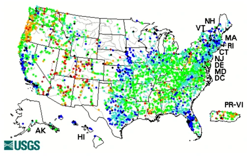
USGS Daily Streamflow Conditions
Click the map below for the USGS Daily Streamflow Conditions throughout the United States. Click the state of North Carolina for local information.
Current data typically are recorded at 15- to 60-minute intervals, stored onsite, and then transmitted to USGS offices every 1 to 4 hours, depending on the data relay technique used. Recording and transmission times may be more frequent during critical events. Data from current sites are relayed to USGS offices via satellite, telephone, and/or radio telemetry and are available for viewing within minutes of arrival.
All real-time data are provisional and subject to revision.
Roadmap to a Cleaner Yadkin
Click here to read Roadmap to a Cleaner Yadkin.
Click here to see the brochure.
Fishweirs
Flowing stream fishweirs (fish dam, fish trap) consist of an obstruction across all or part of a river, creek or stream to trap fish in quantities. Weirs are constructed of cobble, rocks and/or small boulders and often use existing or naturally occurring rocks protruding from the river bed.
Fishweirs are generally “V” or “W” shaped, with an apex aligned downstream directing fish towards traps, usually nets or baskets. They also can be a diagonal dam across the stream. The actual width of the wing and dam walls, and the size and V shape can greatly very.
Our board member David White did a great online presentation on the fish weirs from Shoals to Donnaha to make up for our canceled paddle on that section. David has spent years researching and paddling this section, and it is a top-notch introduction to the weirs.
You can see his entire presentation here.
To view a 10 minute video on the Great Bend Fishweirs, click here.
Harmful Algal Blooms (HABs)
Harmful Algal Bloom Fact Sheet
Brian Fannon’s Blog Post on HABs
RESPONDING TO HARMFUL ALGAL BLOOMS:
A Guide for North Carolina Waterkeepers, Government Agencies, and Water Quality Advocates
Threats
The Yadkin River and its Lakes face numerous threats, including:
- Nutrient pollution (phosphorus and nitrogen) from municipal wastewater treatment plants, urban stormwater runoff and industrial scale animal feeding operations.
- Harmful algal blooms or HABs that can be hazardous to humans, pets and wildlife aused by excessive nutrients and exacerbated by increased temperatures caused by climate change.
- Legacy of toxic pollution from inactive hazardous waste disposal sites, including the Alcoa Badin Business Park in Badin, NC that are leaching contaminants into Badin Lake/Yadkin River and Little Mountain Creek.
- Erosion and sedimentation caused by over development and clearcutting.
- Flooding and contamination caused by more intense/frequent storms caused by climate change.
- Trash and plastic waste that can harm wildlife and breakdown into microplastics that can be harmful to humans and wildlife.
Outfitters
Professional outfitters, guides and clubs are available to assist you in boating or fishing on the Yadkin River and its lakes. Contact these outfitters for more information on their services.

Foothills Outdoor Adventures
Services: Canoe, Kayak, Tube, Bike Rentals
Contact: (336) 990-0000
2618 West NC Hwy 268, Wilkesboro, NC 28697
www.foothillsoutdooradventures.com
Get:Outdoors
Services: Canoe and Kayak Rentals; Day and Weekend Trips, Sales, Instruction
Contact: (336) 294-3918; greensboro@getoutdoors.us
www.getoutdoors.us/rentals/index.html
Great Outdoor Provision Company
Thruway Shopping Center
402 South Stratford Rd.,
Winston Salem, NC 27103
Services: Clothing, Gear, Canoe & Kayak Sales, Travel, Tech Toys
Contact: (336) 727-0906
www.greatoutdoorprovision.com
NC River Riders
201 Big Bend Road, Ronda, NC
Services: Canoe, Kayak & Tube Rentals, Shuttle Services
Contact: (336) 244-6220; NCRiverRiders@gmail.com
www.northcarolinariverriders.com
Row Co River Adventures, LLC
Services: Kayak Rentals, Shuttle Transportation
Contact: (704) 870-8362
www.rowcoriveradventures.com
Report a Concern
Do you see a problem with your water?
Complete the form below to report a water quality issue or incident.